 6Photo© hindustantimes.com
Israel Apologises After Sharing Map Showing J&K in Pakistan, Northeast India In Nepal
A diplomatic stir erupted this weekend after the Israeli Defence Forces (IDF) released a regional map misrepresenting India's territorial boundaries, sparking widespread outrage and prompting a formal apology.
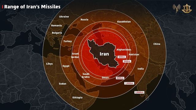
The controversy began on Friday when the IDF shared a graphic highlighting the reach of Iranian missiles in the wake of escalating hostilities between Israel and Iran. The map inaccurately portrayed Jammu and Kashmir as part of Pakistan and parts of Northeast India within Nepal's borders. India's inclusion within the missile range was part of the broader illustration.
The post, which was intended to showcase Iran's military capabilities, carried a stark warning: “Iran is a global threat. Israel is not the end goal, it’s only the beginning.” It went on to justify the military operation, stating, “We had no other choice but to act.”